West bottoms in three parts 2022-2023 vision study
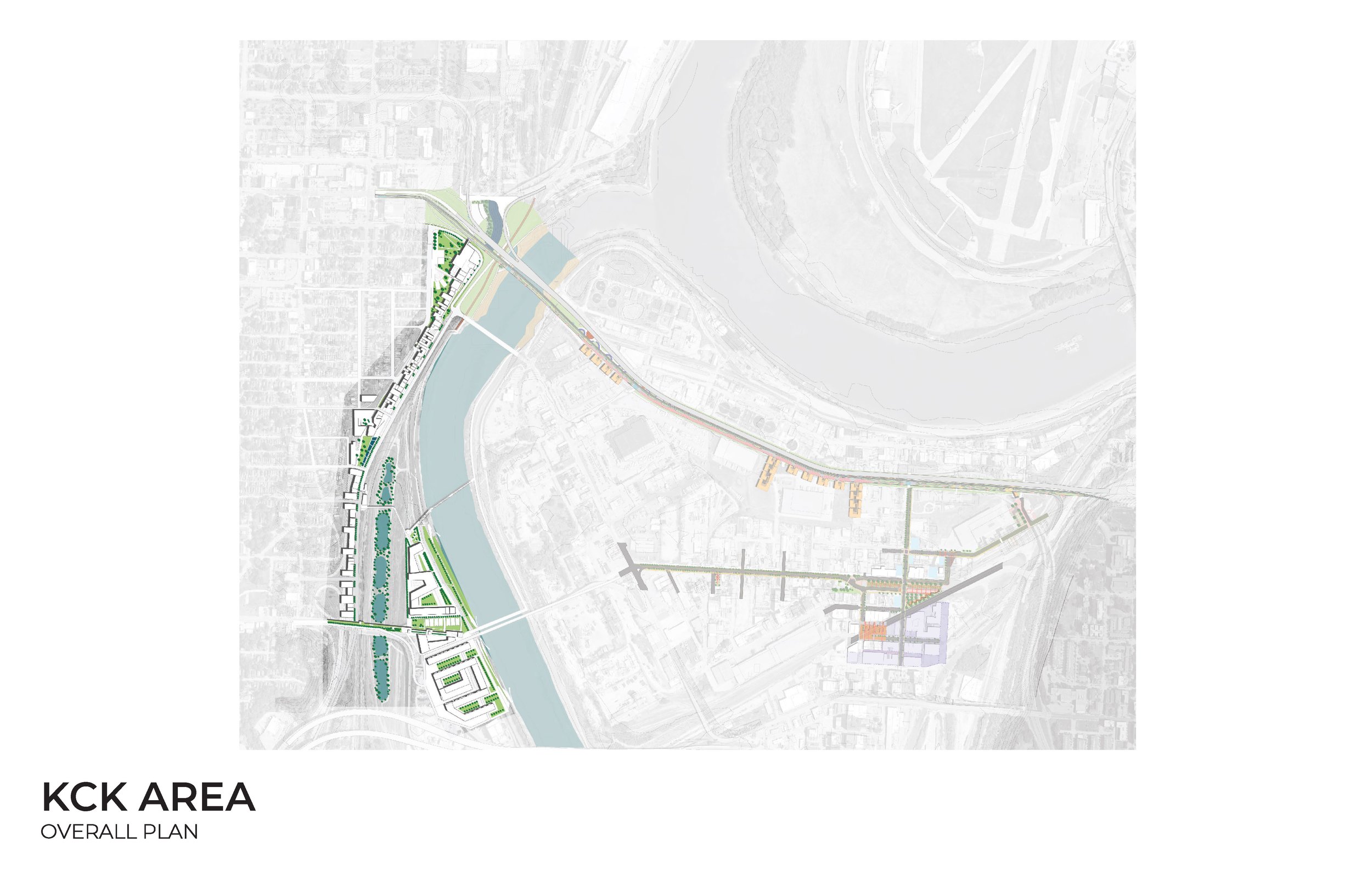
KCK study area
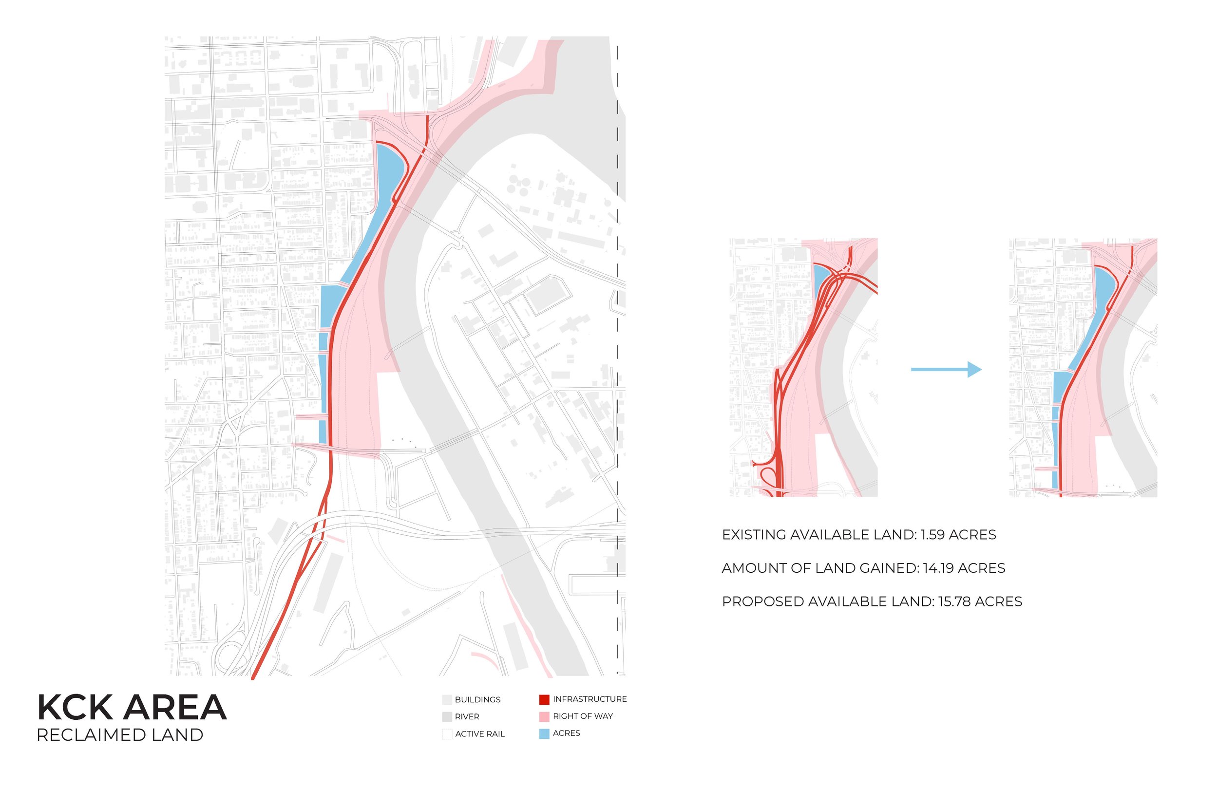
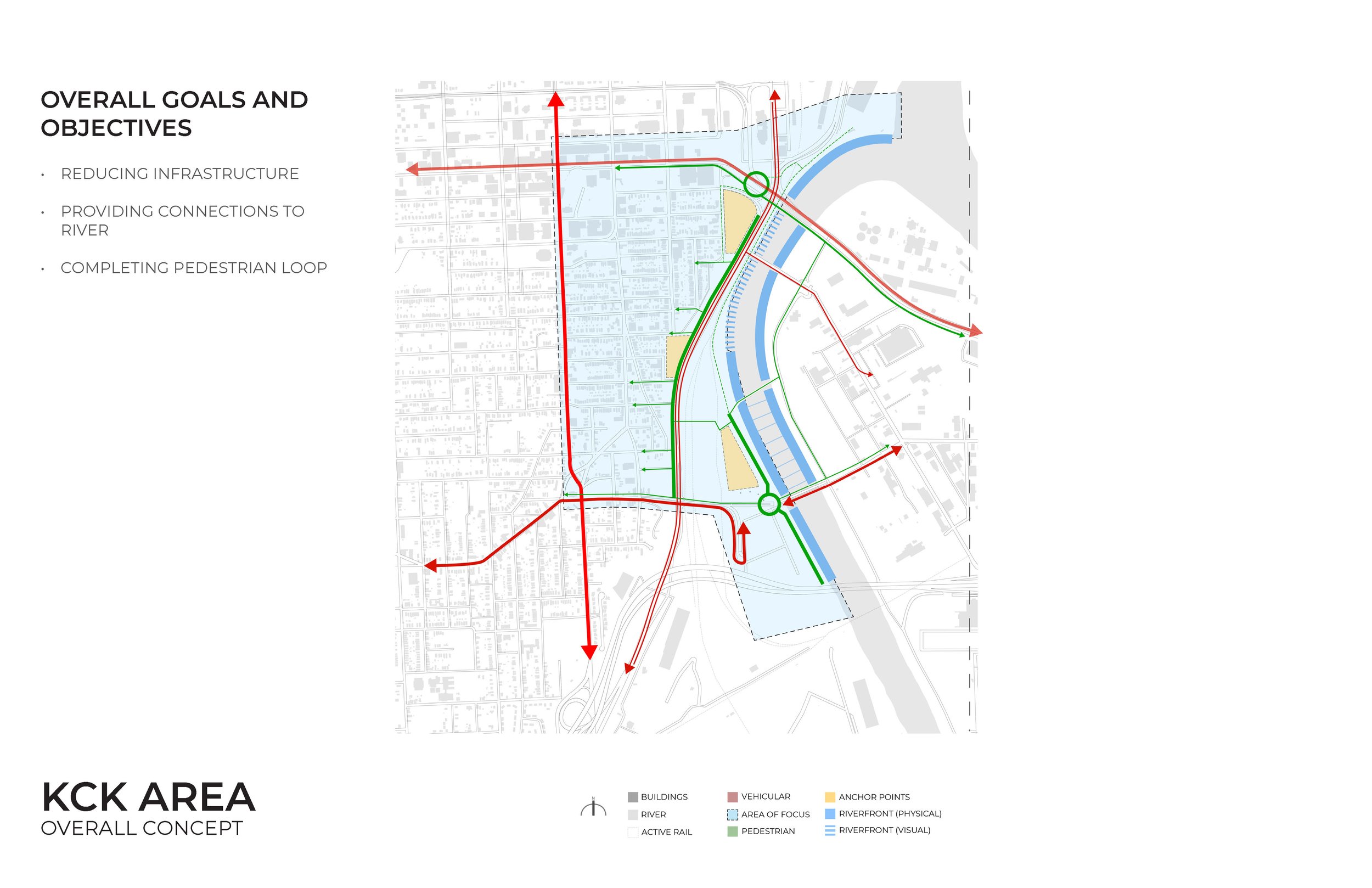
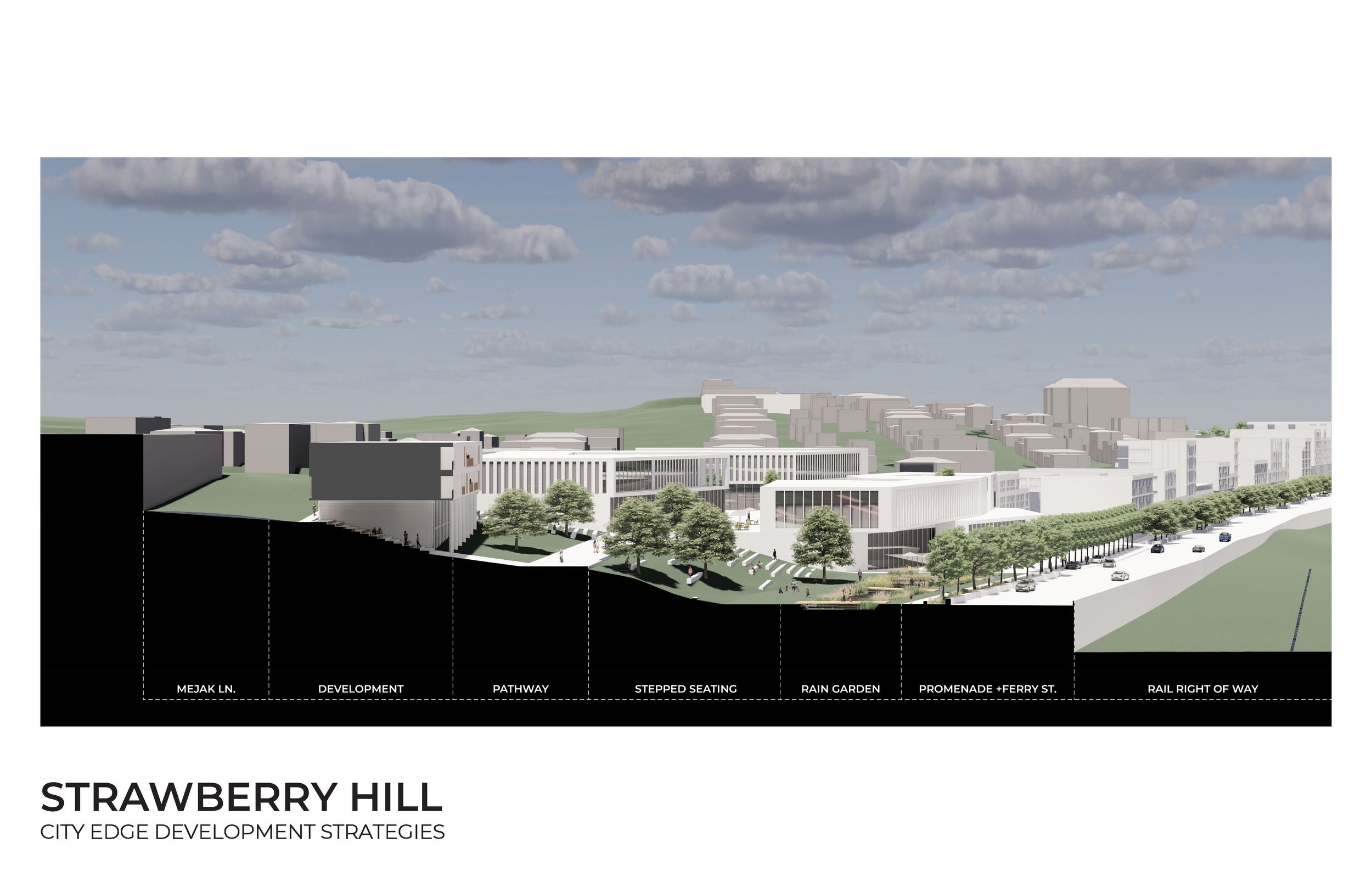
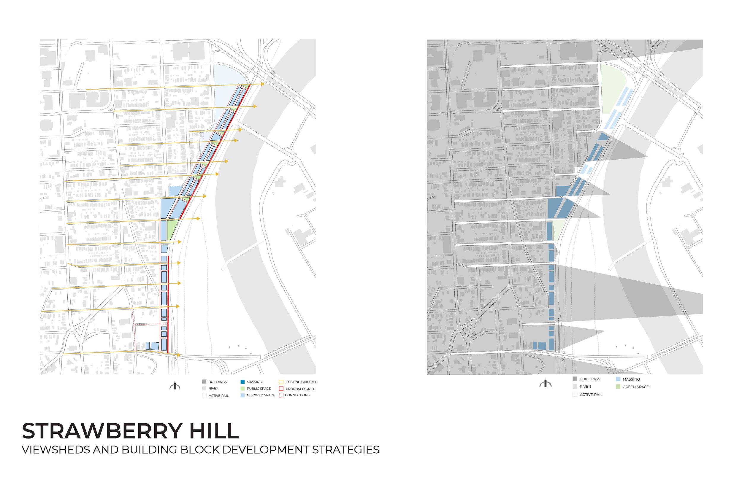
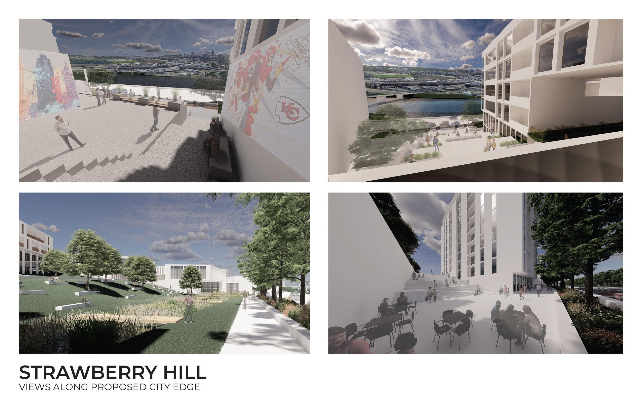
Downtown Kansas City, Kansas has a unique geographical position that defines its Eastern edge. Its elevated bluff position above the Kansas River and the confluence with the Missouri River commands a prominent topological presence grounded in expansive panoramic views to the East, binding it visually with its Missouri counterpart. However, this prominence is simultaneously challenged by the interface with the infrastructure of I-70 which results in a tangle of on and off-ramps that claim valuable territory that would otherwise allow the city to connect to the river and turns it into an infrastructural wasteland. The impending realignment and reconstruction of the I-70 westbound off and on ramps will create a unique opportunity to rethink the interface with the city and create a better juxtaposition of the contesting ordering systems of highways, street patterns, and topography and connect and extend usable public realm towards the river.
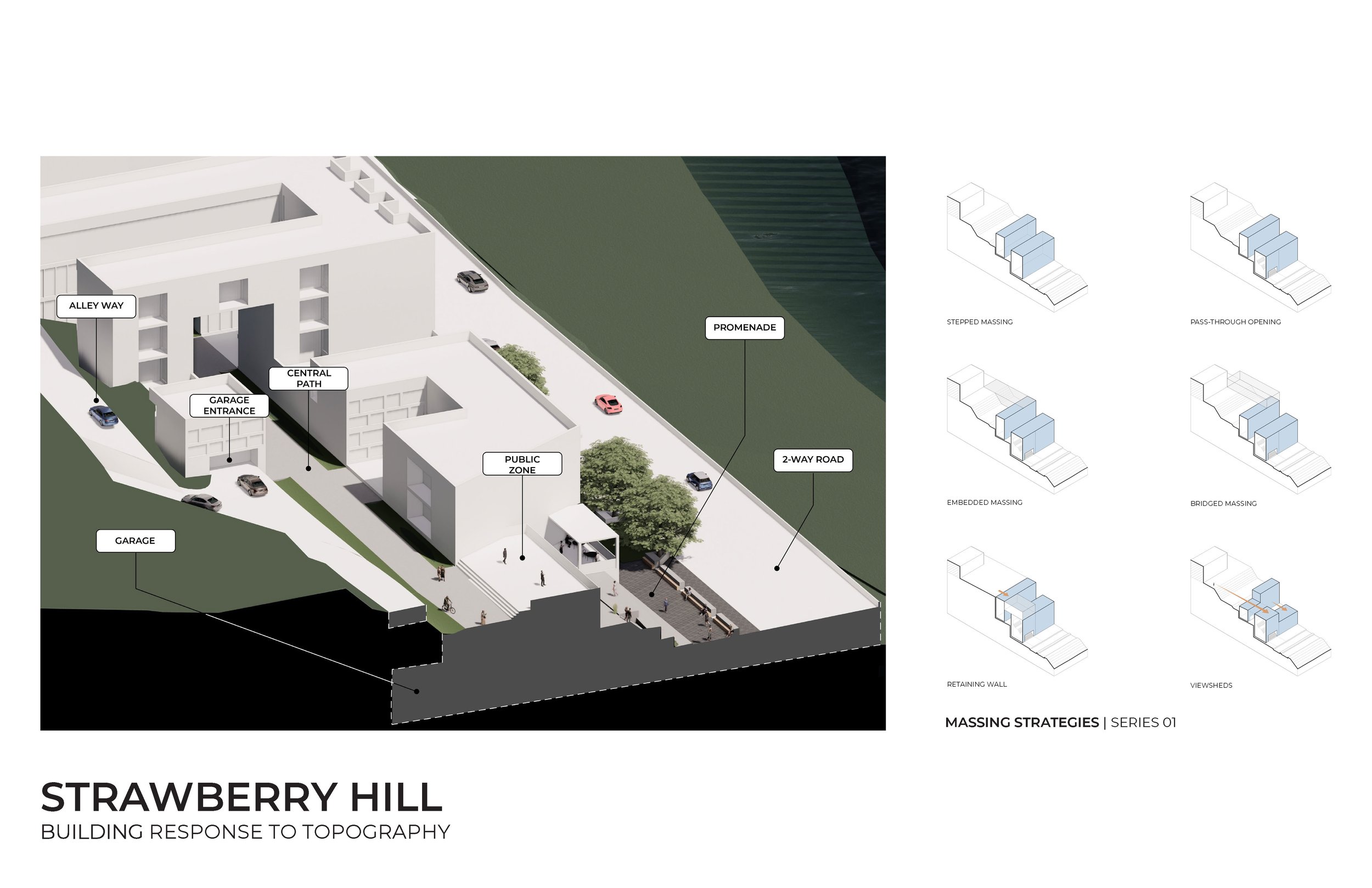
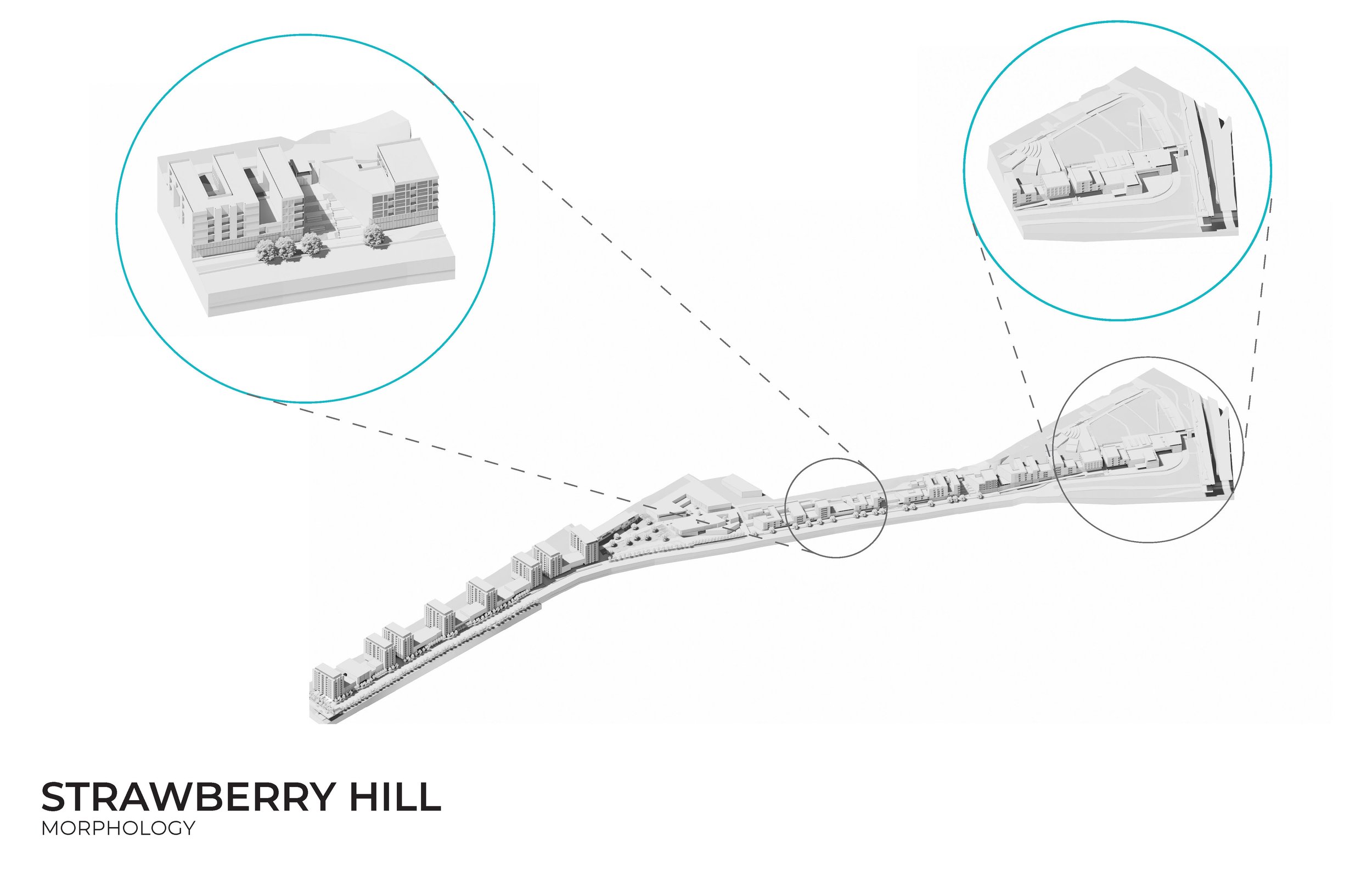
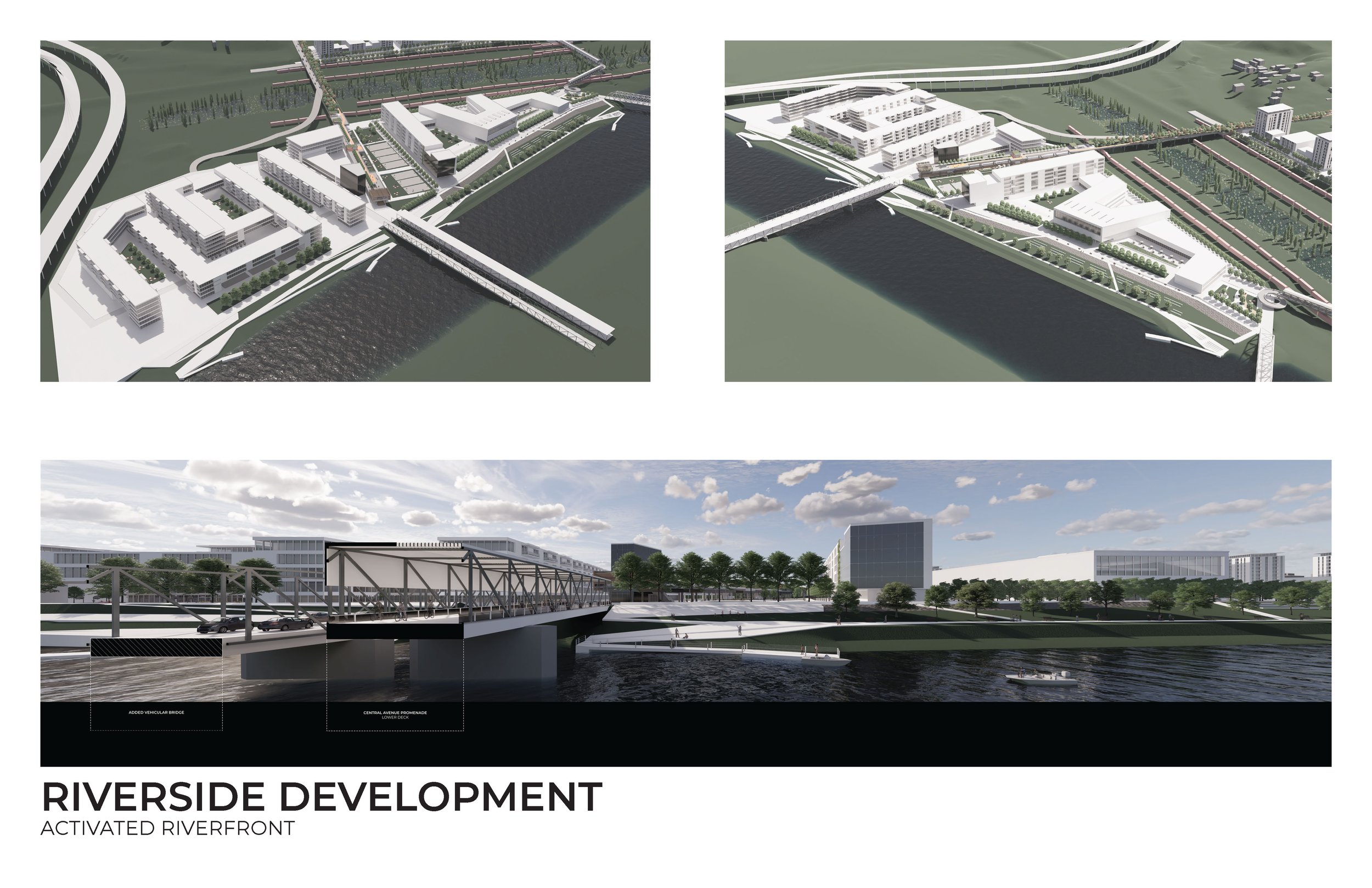
The main purpose of this section of the project is to examine in detail and propose alternatives for better intersection with and eventual reduction of interstate infrastructure and find the way in which the continuation of the street patterns and accessible public realm can be interwoven with the new construction and the negotiation of the challenging topography, ultimately creating a usable city territory that benefits its inhabitants. The design focuses on examining opportunities for reclaiming and redeveloping the industrial land and the riverfront between I-70 and I-670 bounded by the bluff and topographical shift to the West. The design investigations draw from the previous 2020/21 KCDC vision study for the redevelopment of the industrial riverfront in Kansas City, Kansas, and center on pursuing the already established objectives of the activation of the riverfront, creation of the continuous public realm, overcoming the infrastructural separation from the rest of the city and exploring the modes of the mixed-use development.
The study centers on offering a tangible design vision for rethinking urban infrastructure and underutilized industrial land towards the creation of a more inclusive concept of mixed-use urban environment and a shared public realm where the identity of the place is derived from the experience of its constituting working parts and the juxtaposition of traditionally considered mutually exclusive land use opposites. In that regard, the design centers on developing strategies for merging the city and its topography in creating a morphological interface that defines a missing formal edge of the city where two different conditions and land uses intersect creating a new sense of urbanity.