Project Advisory meeting #2
/This week, for our second advisory meeting, the studio had eight individuals with distinct insight on the East Bottoms area at the KCDC to review our findings. These individuals included professionals from Port KC, KCMO City Planning, and local sustainability experts to help guide us in the right direction. With half of the semester down, the studio is focusing on analytical studies to narrow down potential sites. The materials we are using to do this includes drone footage, precedents, slide shows, and vignettes to help guide our reviewers on the character of the site. For this advisory meeting, we were looking for insights on the possibilities of each section and how they connect.

The discussion started with us considering water management, such as the levee expansion, and how to work with the challenge of potential flooding. Since the site is on a floodplain, the reviewers recommended looking at the Houston Bayou system. Houston has many of the same flooding problems as the East Bottoms and to remedy the issue they created a bayou system that is designed to flood while continuing to serve public needs through green space. This system successfully solves two problems with one solution and the studio is now investigating this precedent in relation to our site. The challenge of restoration and protection was brought up again later in the review— is it possible to use our site when it is saturated due to flooding?

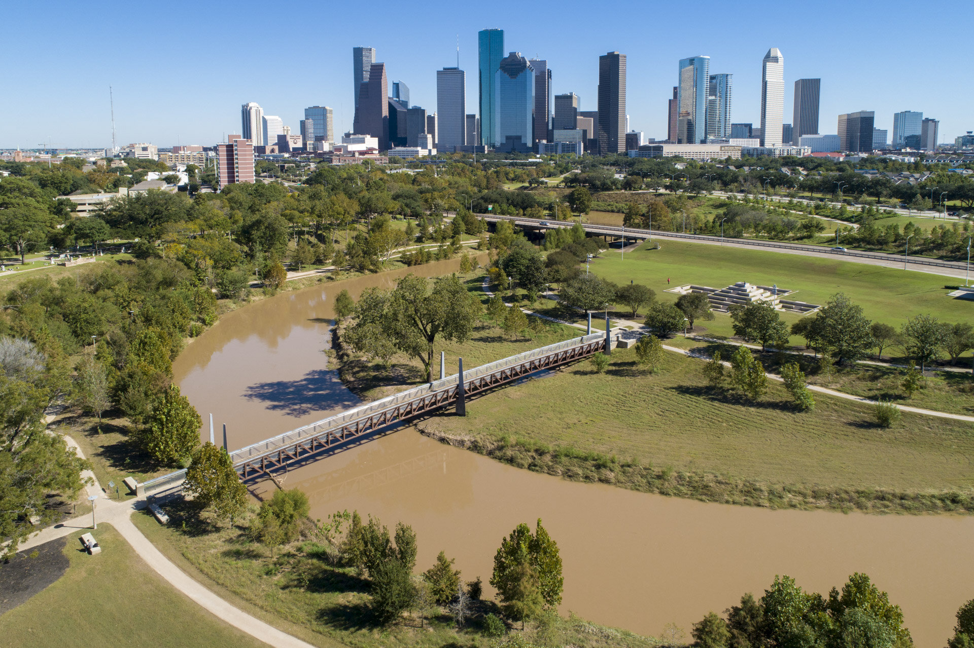
Above: Houston’s system of Bayous that are designed to handle flooding
For the ‘Identity’ section of the project, it was advised that we map out the current activities of the area. Since the East Bottoms is made up of multiple identities, could this be a strength that we can capitalize on? We found that could elaborate further on the five types of sites we have discovered in the East Bottoms.

When investigating ‘Connections’, it is important to note that our site is 990 acres and has the third largest levee system in the country. Could these be used as opportunities to create more public green space? Again, the Houston Bayou project is a good precedent for how to examine potential connections. The studio is also looking at the ports and economic qualities of the East Bottoms— there are precedents around the world for port revitalization that could be beneficial for the site.

Map of current levee system along the Missouri, Kansas, and Blue Rivers in the Kansas city Region

The reviewers were enthusiastic with their feedback and we are excited to expand on our analysis in preparation for the next review!